The Ruler tool lets you measure the distance between any two points in feet and inches, saving those measurements as visible length markups on your plan sheet. Because it automatically pulls from the sheet's saved drawing scale, you can trust your dimensions are perfectly accurate.
Ideal for: Estimating linear materials (like piping or conduit), verifying architectural dimensions, and confirming site clearances.
Background - Linarc's intelligent AI algorithm processes each uploaded plan sheet, automatically detecting and saving the drawing's scale. When you create an area markup, the system uses this scale to instantly calculate and save its dimensions (length, width, and area). If the auto-generated measurements seem inaccurate, you can easily adjust them. See Recalibrate a Drawing for guidance.
To add a length markup with the ruler tool
- Select the 'Ruler' tool
- Click the starting point of your measurement, then drag your cursor to draw a line to the end point.
- Use the handles at either end of the drawn line to fine-tune its placement, ensuring it perfectly covers the exact distance you want to measure.
The calculated dimension will automatically appear above the line in feet and inches.
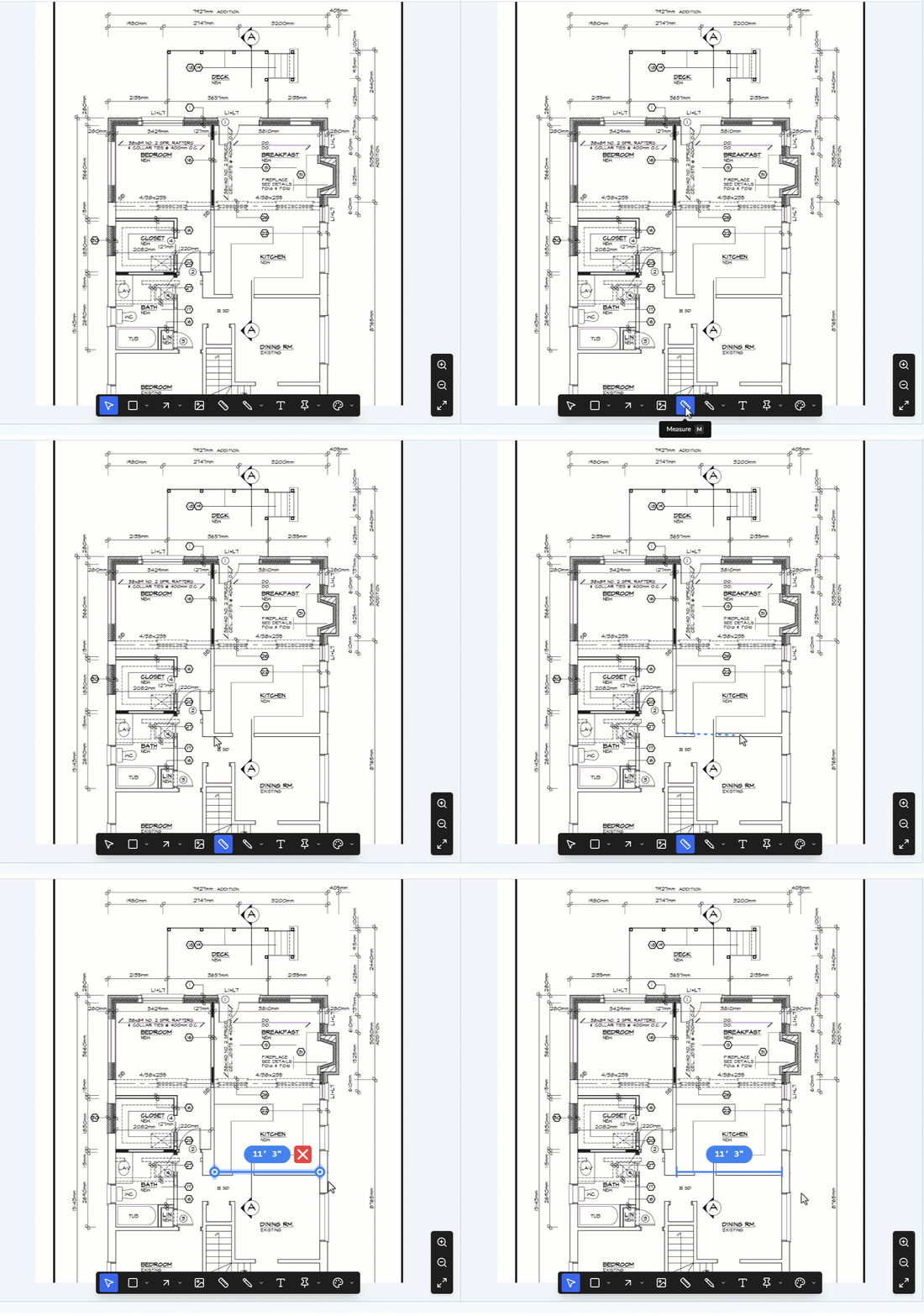
- To reposition: Click the line to select it, then drag it to your desired location on the sheet.
- To duplicate: You can easily clone the markup to apply the exact same length to a different spot on the drawing. See Clone and Reuse Markups if you need guidance on it.
Every line you add is automatically saved as a new layer within the "Current Markup" group, which is visible in the layer editor on the left side of your screen. From this editor, you can manage your shapes:
- Rename: Click the element's label in the editor to give it a brief, descriptive name to keep your markups organized.
- Lock: Hover over the element and click the
 icon to prevent accidental edits or deletion.
 - Hide/Show: Hover over the element and click the
 icon to temporarily hide or show the layer on your plan.
 - Delete: Hover over the element and click the
 icon to remove a mistake.
You can continue selecting tools to add more markup elements as needed. Once you are finished annotating the plan, you must save the layer group. See Publish Markups for detailed instructions on finalizing your work.
Was this article helpful?
That’s Great!
Thank you for your feedback
Sorry! We couldn't be helpful
Thank you for your feedback
Feedback sent
We appreciate your effort and will try to fix the article