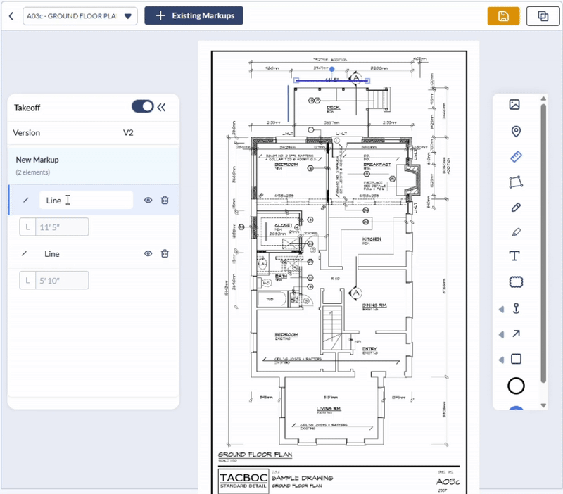
The Takeoff feature lets you create clearly labeled takeoff markups directly on any plan sheet with their auto-calculated dimensions. Each markup is added as an individual layer, making it easy to organize and manage the elements through the Layer Editor panel located alongside the drawing.
Once you've created a group of markups elements, you can save them collectively as a Takeoff Set for future reference or reporting. This ensures consistent tracking of quantities across multiple sessions or team members.
Each markup element displays its dimensions in two places:
- Directly on the drawing, adjacent to the markup, for quick visual reference.
- Within the Layer Editor, which lists all elements in the markup set along with their corresponding measurements.
This dual-view system allows for efficient quantity takeoff management, making it easy to review, modify, or export data as needed.
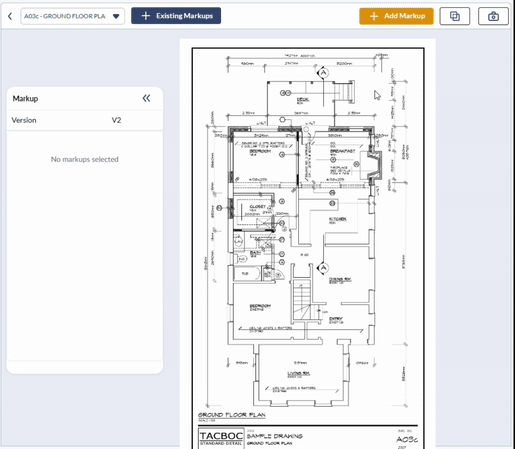
You can view, access, and manage the takeoff markups from the Takeoff screen in the Plans module. See View and Manage Takeoff Markups for more details.
To create takeoff markups
- Ensure that you are on the desired plan sheet. If not,
- Open the Plans module of the project by clicking the app launcher, selecting 'Documents,' and clicking 'Plans' from the top
- The Plans module opens at the Plan Sheets screen
- Click the thumbnail of the sheet you want to open
- Click 'Add Markup' at the top right to open the tools pane
- Expand the layer editor pane by clicking the right arrow
- Use the toggle switch at the top to select 'Takeoff'
Prerequisite: Calibrate the Ruler Tool
If Linarc’s AI cannot auto-detect the scale when you begin a markup, the system will notify you. In such cases, you must manually calibrate the measurement tool.

For step-by-step guidance, refer to "Calibrate a Drawing" to learn how to add a properly scaled ruler markup.
Use the links below to jump to the section you need help with:
Add Length Measurements
You can use the line tool to highlight the length or distance to be measured and recorded as takeoff
To add a length measurement
- Click the arrow in the tools pane and choose the Line tool from the options.
- Click on the starting point of the measurement on the plan sheet to place the Line on the Plan.
- Drag the line to the desired endpoint covering the length to be measured.
- Use the handles at either end of the line to rotate or resize it for precise alignment and length.
The line is added as a new layer in the drawing and appears in the Layer Editor with its calculated dimension and a default label.
- Click the label to rename it with a short, meaningful description of the takeoff measurement (e.g., "Wall A - Length").
Add Area Measurements
You can select from a variety of shape tools to highlight areas for takeoff measurement:
- Shape Tools – Rectangle, Ellipse, Triangle
- Cloud Tool
- Freehand Polygon
- Location Tool
The instructions below explain how to use the Rectangle Tool to mark an area. The process is similar for other shape tools, with the exception of the Location Tool, which follows a different workflow. A separate section explains how to use the Location Tool after the rectangle example.
To add an area measurement with the rectangle tool
- Click on Shape Tools in the tools pane and choose Rectangle.
- Draw the shape roughly on the spot using a click-and-drag action.
- Click and drag the shape to position it precisely where you want it.
- Use the corner and side handles to resize the element as needed.
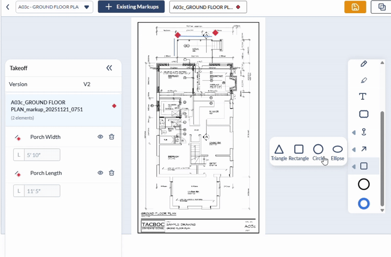
The markup is added as a new layer in the drawing and appears in the Layer Editor with its auto-calculated dimensions and a default label.
- Click the label to rename it with a clear and concise description of the takeoff measurement (e.g., "Dining Room – Floor Area").
To mark an area with the location tool
- Click on Shape Tools in the tools pane and choose Rectangle.
The markup is added as a new layer in the drawing and appears in the Layer Editor with its auto-calculated dimensions and a default label.

- Click the label to rename it with a clear and concise description of the takeoff measurement (e.g., "Closet").
Save the Takeoff Measurements
After adding all your measurement markups, the final step is to save them as a takeoff entry for future reference and reporting.
To save the Takeoff Markup
- Click 'Save Markup' at the top-right.
- Enter a descriptive label summarizing the purpose of the takeoff (e.g., "Ground Floor – Granite Flooring").
- Click OK to confirm and save.

Your takeoff is now stored and can be easily accessed from the 'Takeoff' screen within the Plans module.
For more information, see View and Manage Takeoff Markups.
Was this article helpful?
That’s Great!
Thank you for your feedback
Sorry! We couldn't be helpful
Thank you for your feedback
Feedback sent
We appreciate your effort and will try to fix the article